
DGPS Survey Services
Home Survey Services DGPS Survey
Survey Discipline · DGPS Survey

Every plot,preciselysurveyed.

A Differential GPS survey gives you centimetre-level ground truth before a single brick is laid — accurate boundaries, contours and levels captured with dual-frequency GNSS equipment. TNC Architects delivers CAD-ready survey drawings that feed directly into your architectural and structural design.

Scroll
DGPS SurveyTopographic SurveyGNSS MappingBoundary DemarcationContour MappingRTK SurveySite SurveyAjmer · RajasthanDGPS SurveyTopographic SurveyGNSS MappingBoundary DemarcationContour MappingRTK SurveySite SurveyAjmer · Rajasthan
Survey Engineering

Centimetre accuracy for every plot

Our DGPS surveys use a fixed base station and roving GNSS receiver working together to correct satellite positioning errors in real time — delivering boundary, contour and elevation data accurate enough for legal demarcation, architectural planning and construction layout.

±2cm
Positional Accuracy
GNSS
Dual-Frequency
CAD
Ready Drawings
Get Free Consultation
DGPS Survey Engineering
What We Deliver

Everything included in every project

Control Point & Base Station Setup

DGPS base station established over a known reference point, with control points tied to the WGS84 datum for site-wide coordinate accuracy.

Topographic & Contour Mapping

Dense ground-level shots captured across the site to generate contour lines and a digital terrain model at the intervals your project needs.

Boundary & Land Demarcation

Precise plot boundary marking with area calculation and encroachment identification, cross-verified against revenue and Jamabandi records.

CAD Drawing & Coordinate Data

Final output delivered as AutoCAD DWG/DXF drawings with a live coordinate grid — ready to feed straight into layout and structural planning.

DGPS Survey
TNC Architects · Survey Philosophy

A wrong boundary line is the most expensive mistake to discover after construction begins.

Our Process

Step by step to perfection

01
Site Reconnaissance

Preliminary site visit to identify existing reference points, plot extent and access — the groundwork for an accurate survey.

02
Base & Rover Setup

DGPS base station fixed over a known control point while the rover unit walks the site, logging every boundary corner and ground shot.

03
Data Processing

Raw GNSS data post-processed into WGS84 / local grid coordinates, generating the terrain model and contour lines.

04
Drawing & Report Generation

Final CAD drawings, area statement and survey report delivered — ready to move straight into architectural design.

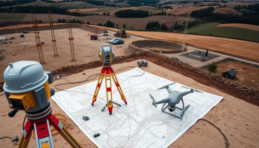
Topographic Mapping
Topographic Mapping
Boundary Demarcation
GNSS Base Station
GNSS Base Station
Contour Survey
Contour Survey
Our Survey Philosophy
"A boundary line drawn wrong on paper becomes a decade-long dispute on the ground."
— Er. Nikhlesh Chauhan · TNC Architects · Ajmer
Discuss Your Project 78779 91122
5+ Years Experience
Established 2021 · 50+ survey and design projects delivered across Rajasthan with complete in-house design.
Certified DGPS Equipment
Dual-frequency GNSS receivers with RTK correction for centimetre-level accuracy on every site.
RERA & Revenue Record Compliant
Survey outputs cross-verified with Jamabandi and revenue records for legally sound boundary demarcation.
What You Receive

Complete deliverables package

Topographic Survey Map
DGPS Control Point Coordinates
Contour Plan (0.5m / 1m Intervals)
Digital Terrain Model (DTM)
Boundary Demarcation Report
Area Calculation Statement
CAD Drawing (DWG / DXF Format)
Site Survey Report with Coordinates
DGPS SurveyTopographic SurveyGNSS MappingBoundary DemarcationContour MappingRTK SurveySite SurveyAjmer · RajasthanDGPS SurveyTopographic SurveyGNSS MappingBoundary DemarcationContour MappingRTK SurveySite SurveyAjmer · Rajasthan
Why TNC Architects

Reasons clients trust us

GNSS Certified

Dual-frequency DGPS / RTK equipment delivering survey-grade accuracy on every project, large or small.

Fast Turnaround

Base station setup to final CAD drawing delivered within days — not weeks — so your project keeps moving.

Design-Ready Data

Survey coordinates handed straight to our architectural and structural teams — zero data loss, zero re-entry.

Legally Sound

Boundaries cross-checked against revenue records and Jamabandi, reducing the risk of future disputes.

Common Questions

Frequently asked questions

What is a DGPS survey?
DGPS (Differential GPS) survey uses two GNSS receivers — a fixed base station and a moving rover — working together to correct satellite positioning errors, achieving centimetre-level accuracy far beyond a standard handheld GPS.
How accurate is a DGPS survey?
Under good satellite conditions we achieve accuracy of up to ±2cm horizontally — precise enough for legal boundary demarcation, topographic mapping and construction layout work.
Do you provide contour maps?
Yes — contour plans are generated at whatever interval your project needs, typically 0.5m or 1m, along with a digital terrain model for grading and drainage design.
Can a DGPS survey help resolve boundary disputes?
Yes — our boundary demarcation is cross-verified against revenue records and Jamabandi, giving you a legally sound reference point for any dispute or sale transaction.
How long does a DGPS survey take?
A typical residential plot is surveyed within a day or two; larger sites take longer. CAD-ready drawings are usually delivered within a few days of fieldwork completion.
Explore More

Complete design under one roof

Start Your Project

Ready to map your land?

Let TNC Architects handle everything — from DGPS field survey to CAD-ready drawings to final architectural design. One call sets everything in motion.

50+
Projects
5+
Years
5
Disciplines
100%
In-House